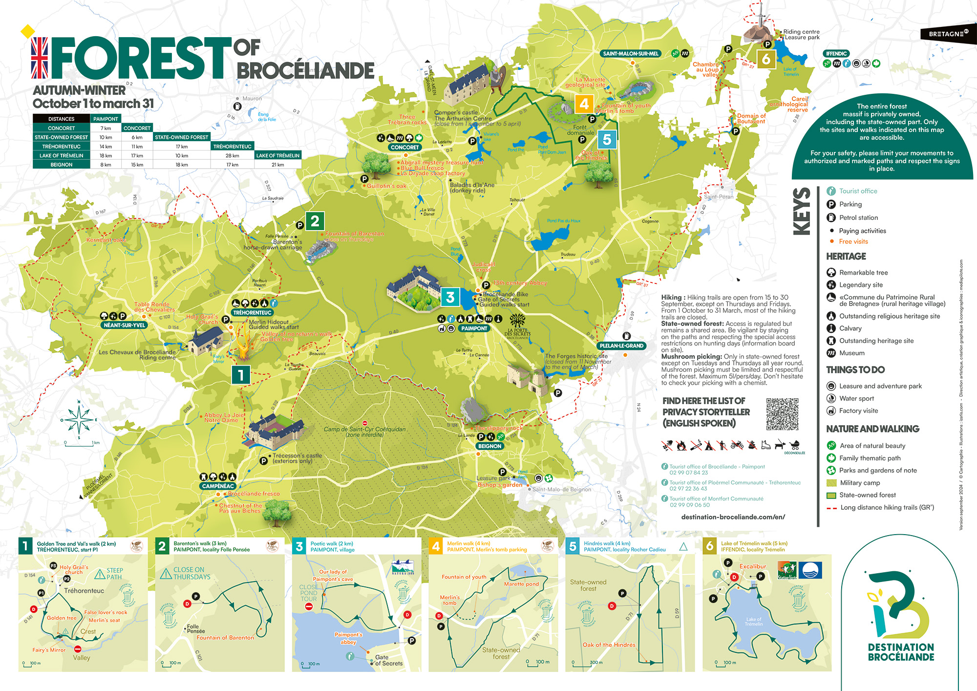
The appearance and appeal of the forest change throughout the year. Some areas can be closed depending on the season. Spend a few minutes studying the forest map and select our recommended or favourite itineraries, for a pleasant, worry-free exploration.
Download the spring/summer map Download the fall/winter map
Download the map of accessible sites
Hunting season from mid-September until the end of March : access to trails and legendary sites is highly regulated.
The forest of Paimpont (or Broceliande forest) is 90% privately owned and covers nearly 12,000 hectares.
From October to March, it is the period of forestry and hunting but it remains accessible !
The private part is hunted every day but the small walks and sites remain accessible and protected.
The 10% state-owned part is located in the north-east, around Merlin’s Tomb and the Hindrés oak.
The state-owned part is not hunted every day (see calendar days of hunting in the state-owned part).


